")
")
")


Capanna Trieste is located over the wide rocky riverbed, inside an active debris gorge. The surrounding rocks belong to the Schlern Formation, its appearance visibly changed by vegetation: at the top looms the slanting silhouette of Torre Trieste (2458m) with its 800-metre high vertical wall; Cima della Busazza (2894m) is to the left with a wall of 1100 metres and to the right is the edge of Van delle Sasse as well as Cima delle Sasse.
Half of Torre Trieste is carved of Main Dolomite, the lower part of Busazza is composed of dolomite, the top part of Grey Limestones. The Val dei Cantoni still hosts a small glacial valley (el Giazer or Glacier de Gasperi), another glacier-snow covered largely with debris is located on the Van delle Nevere, at the base of the Moiazza.
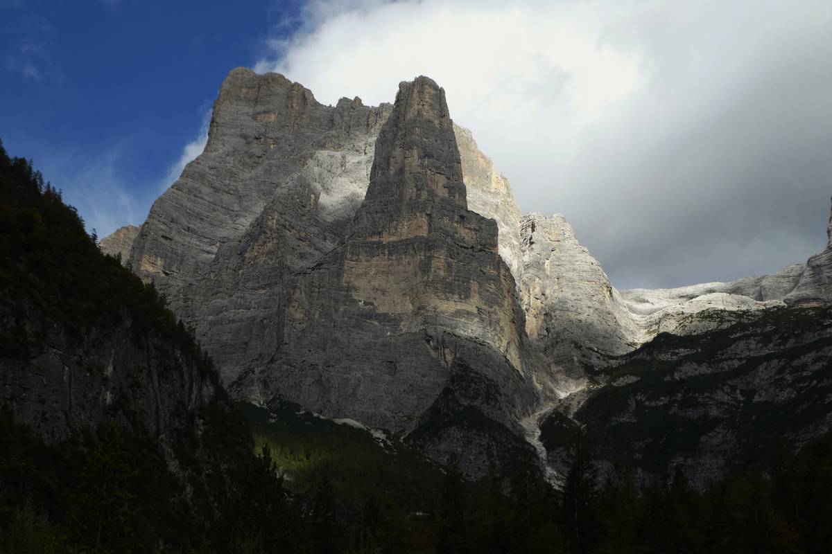 Torre Trieste and Van delle Sasse from Capanna Trieste (photo DG)
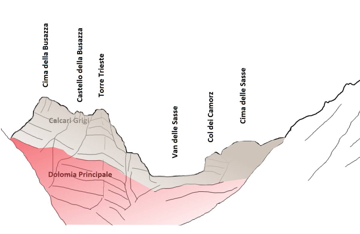 Geological sketch of Torre Trieste and Cima della Busazza (illustration by DG).
At the time when the Würmian glaciation was at its peak, approximately 20000 years ago, the main Cordevole glacier was roughly 1600 metres high in this area and the minor glaciers converged laterally over it. A glacier tongue fed by local glacier cirques reached as far as Val Corpassa. The largest of these hanging cirques is in Van delle Sasse (reachable in roughly 3 hours on foot via CAI trail). Even though nowadays it does not contain any glacial structure from the last late glacial stages, it still retains evident signs of the last late glacial stages.
Download
 |
Download the full content of the information panel number 19 (pdf format) |